Aetheria Grid: Reimagining Google Maps for Architectural Precision
Unlocking a New Dimension of Site Analysis and Design Conceptualization for Professionals.
Aetheria Grid: Reimagining Google Maps for Architectural Precision
Unlocking a New Dimension of Site Analysis and Design Conceptualization for Professionals.
For architects, urban planners, and interior designers, the foundation of every successful project lies in a profound understanding of its site. Yet, the ubiquitous mapping tools we rely on daily, while excellent for navigation, often fall short of providing the precise, uncluttered, and context-rich spatial understanding that design professionals demand. Standard consumer-grade maps, with their vibrant color palettes, busy points of interest, and emphasis on navigation, introduce visual noise that can obscure critical design elements and hinder conceptualization.
The Imperative for Design-Centric Mapping: Why Standard Maps Fall Short
Imagine trying to sketch a delicate architectural detail on a brightly colored, heavily textured background. The background competes for attention, making it difficult to discern your lines and forms. This is precisely the challenge designers face when attempting to use conventional maps for professional work. They are designed for general public use, prioritizing immediate recognition of landmarks and routes over the nuanced spatial relationships vital to design.
- Visual Clutter: Overlays of irrelevant businesses, traffic data, and tourist attractions distract from the core urban fabric.
- Inadequate Information Hierarchy: Key architectural elements like building footprints, property lines, or topographical changes are often downplayed or obscured.
- Unsuitable Aesthetics: Bright, often primary color schemes clash with professional design presentations, making it difficult to overlay design concepts seamlessly.
- Lack of Precision: While geographically accurate, the visual representation isn't optimized for the detailed analysis required for site planning and design.
This gap has long necessitated time-consuming workarounds: exporting, cleaning, and re-styling maps in design software, adding an unnecessary layer of effort to every project's initial phase.
Introducing Aetheria Grid: A Professional's Canvas
We are thrilled to introduce Aetheria Grid, a revolutionary new Google Maps style crafted specifically for architects, urban planners, and interior designers. Aetheria Grid is not just another map; it's a sophisticated, minimalist visual language designed to transform standard mapping into an essential tool for project conceptualization. It provides a precise, uncluttered, and context-rich spatial understanding, supporting detailed site analysis, conceptual design, and client presentations by offering an elegant, functional base layer.
Aetheria Grid prioritizes clarity and precision, reducing visual noise to highlight critical spatial relationships and contextual elements. It allows designers to overlay their work seamlessly, without visual interference, turning the map into a true professional canvas.
Core Design Principles: Clarity, Context, and Neutrality
The development of Aetheria Grid was guided by a set of rigorous design principles, ensuring it meets the exacting standards of the design industry:
- Clarity over Clutter: Emphasizes essential urban fabric, de-emphasizing secondary details to bring focus to what truly matters for design.
- Contextual Precision: Highlights building footprints, topography, and public spaces accurately, providing a reliable foundation for analysis.
- Neutral Foundation: Offers a versatile, understated base that serves as a perfect backdrop for design overlays, allowing your work to stand out.
- Scalability: Maintains legibility and aesthetic integrity across all zoom levels, from broad urban planning views to detailed site sections.
- Information Hierarchy: Utilizes subtle color and line weight variations to convey importance without overwhelming the viewer.
- Professional Aesthetic: Reflects the sophisticated visual standards of the design industry, enhancing the perceived quality of your presentations.
- Print-Ready: Optimized for both digital display and high-quality print outputs, ensuring consistency and excellence in all mediums.
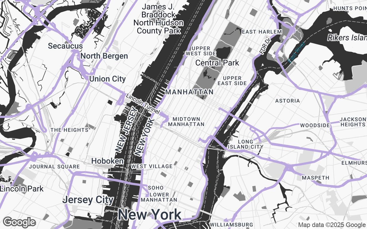
A Palette of Purpose: Understanding the Aetheria Grid Color Scheme
The visual language of Aetheria Grid is meticulously crafted using a purpose-driven color palette, designed to support, not distract from, your design work:
- Neutrals (F8F8F8, E0E0E0, C7C7C7, AFAFAF, 969696): These varying shades of grey form the backbone of the map, providing a calm, unobtrusive background for land, roads, and less critical features. They ensure that the map recedes, allowing your design to take center stage.
- Primary (#333333): A deep, rich charcoal used for essential text, prominent building outlines, and primary road networks. This provides clear legibility and definition without being harsh.
- Secondary (#888888): A softer grey for less critical text, secondary roads, and subtle boundary lines, maintaining hierarchy and visual balance.
- Accent (#B39DDB): A sophisticated, muted lavender. This color is strategically deployed to highlight specific points of interest, public transport lines, or user-defined features, drawing attention where needed without overwhelming the overall neutrality.
This carefully curated palette ensures that Aetheria Grid is not just functional but also aesthetically pleasing, aligning with the sophisticated visual standards of architectural and design presentations.
Enhanced Site Analysis: From Footprints to Flow
Aetheria Grid transforms the initial phase of any project – site analysis – into a more efficient and insightful process. With its emphasis on Contextual Precision and Clarity over Clutter, designers can quickly grasp:
- Building Footprints and Massing: Clearly defined building outlines provide immediate understanding of urban density and spatial relationships.
- Topographical Contours: Subtle yet clear elevation changes inform design decisions related to grading, drainage, and views.
- Public Spaces and Green Infrastructure: Parks, plazas, and greenways are distinctly rendered, highlighting opportunities for integration and enhancement.
- Circulation and Connectivity: Road networks, pedestrian pathways, and public transport routes are presented with an intelligent hierarchy, aiding in flow analysis and access planning.
- Property Lines and Boundaries: Essential for legal and planning considerations, these are rendered with precision and clarity.
Seamless Integration: Overlaying Designs on a Clean Base
The Neutral Foundation principle is where Aetheria Grid truly shines for design conceptualization. Its understated aesthetic provides the perfect backdrop for overlaying your own design work. Whether you're sketching initial ideas, presenting detailed CAD drawings, or showcasing BIM models, Aetheria Grid ensures your design elements are the focal point. There's no visual competition from the map itself, allowing for a pure, unadulterated view of your proposed interventions.
This seamless integration means less time spent on graphic adjustments and more time dedicated to the creative process, fostering a more intuitive and fluid workflow from concept to presentation.
Optimized for Print and Digital: Versatility in Presentation
Recognizing that professional work is presented across various mediums, Aetheria Grid is meticulously Print-Ready. Its balanced contrast and carefully chosen line weights ensure that maps look crisp and legible whether viewed on a high-resolution digital display or printed on large-format presentation boards. This versatility guarantees that your project documentation and client presentations maintain a consistent, professional aesthetic, reinforcing the quality of your design work.
Transforming Workflow: How Aetheria Grid Elevates Project Conceptualization
By providing a map style that truly understands the needs of design professionals, Aetheria Grid fundamentally elevates the entire project workflow:
- Accelerated Site Understanding: Quickly identify key opportunities and constraints without visual distractions.
- Improved Conceptualization: A clean canvas fosters clearer thinking and more focused design development.
- Enhanced Client Communication: Present your designs on a sophisticated, easy-to-understand base map that reinforces your professional image.
- Reduced Pre-Design Labor: Minimize the time spent cleaning and re-styling generic maps, allowing more time for actual design.
- Consistent Visual Language: Maintain a high standard of graphic presentation across all project phases.
Aetheria Grid empowers architects, urban planners, and interior designers to move beyond mere navigation and truly engage with the spatial context of their projects, fostering innovation and precision at every step.
Future Directions: Expanding the Professional Mapping Toolkit
The introduction of Aetheria Grid is just the beginning. We envision a future where professional mapping tools are even more deeply integrated into the design ecosystem. Future enhancements may include:
- Direct Integration with Design Software: Plugins for popular CAD, BIM, and 3D modeling applications.
- Specialized Data Layers: Options for overlaying zoning regulations, utility infrastructure, historical data, or environmental factors.
- Customizable Thematic Overlays: Allowing designers to dynamically highlight specific data points relevant to their project needs.
- Advanced 3D Terrain Visualization: More sophisticated representation of topography and existing building massing.
Aetheria Grid represents a significant leap forward in professional mapping, offering a tool that is as precise and elegant as the designs it helps create. It's time to reimagine your site analysis and design conceptualization with a map style built for you.