Urban Blueprint: A Google Maps Style for Architectural Vision
Transforming Google Maps into an Essential Tool for Architects and Interior Designers, Emphasizing Precision, Context, and Aesthetic Harmony.
Urban Blueprint: A Google Maps Style for Architectural Vision
Transforming Google Maps into an Essential Tool for Architects and Interior Designers, Emphasizing Precision, Context, and Aesthetic Harmony.
In the intricate world of architecture, interior design, and urban planning, every detail matters. From the initial site analysis to the final client presentation, professionals rely on tools that offer clarity, precision, and an intuitive understanding of space. Yet, for too long, the ubiquitous digital map – a foundational resource for understanding context – has fallen short of these exacting standards. Standard mapping styles, designed for general navigation, often present a cacophony of visual information, distracting from the nuanced spatial relationships and contextual elements critical to design.
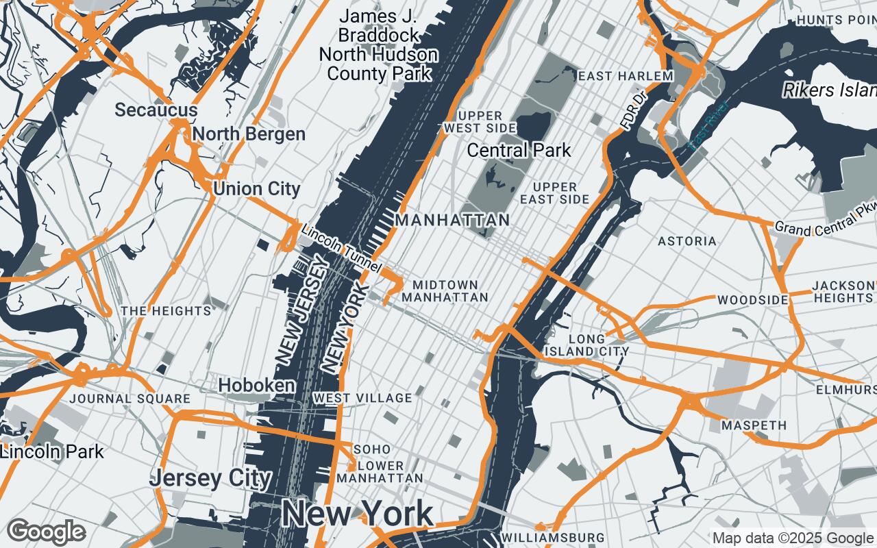
Enter Urban Blueprint, a revolutionary Google Maps style meticulously crafted for the discerning professional. It's not just a map; it's a design companion, engineered to complement your creative process rather than distract from it. Urban Blueprint transforms Google Maps into a clean, uncluttered, and highly functional canvas, optimized for visualizing projects within their real-world environment with enhanced clarity and precision.
Core Philosophy: Precision, Clarity, and Context in Mapping
Urban Blueprint was born from a singular brief: to provide a map style that prioritizes spatial relationships, material textures, and contextual elements over distracting visual noise. Our design philosophy is rooted in a set of core principles that guide every pixel and line:
- Clarity over Clutter: We minimize unnecessary visual noise, ensuring that only essential spatial information is prominently displayed.
- Contextual Harmony: The style seamlessly integrates with your design workflow, acting as a supportive backdrop rather than a competing visual element.
- Materiality & Texture Cues: Subtle visual hints of surface types and urban textures are incorporated, offering a richer understanding of the environment.
- Layered Information: Data is presented hierarchically, allowing you to delve deeper into details as needed without overwhelming the initial view.
- Sophisticated Palette: A professional, non-distracting color scheme supports intense design focus and aesthetic appreciation.
- Scalable Detail: Appropriate levels of detail are presented across all zoom levels, maintaining legibility from a bird's-eye view to street level.
- Legibility & Precision: All labels, geometries, and features are rendered with crispness, ensuring they are sharp and easily discernible.
- Architectural Grid Alignment: An implicit support for spatial reference is woven into the clean, structured layouts, aiding in conceptualization.
This commitment ensures that Urban Blueprint is more than just a navigational aid; it's a tool for conceptualization, analysis, and presentation.
The Urban Blueprint Palette: A Foundation for Design Visualization
Central to Urban Blueprint's effectiveness is its carefully curated color palette. Eschewing vibrant, attention-grabbing hues, we've opted for a sophisticated, understated scheme that allows your design work to take center stage. The palette is designed to be visually calming yet informative, providing a solid foundation for design visualization:
- Primary (#2C3E50): A deep, grounding charcoal blue, used for primary landmasses and significant urban features, providing a stable visual anchor.
- Secondary (#7F8C8D): A subtle, muted grey, offering gentle contrast for secondary elements and less prominent features, ensuring differentiation without distraction.
- Accent (#E67E22): A warm, inviting orange, reserved for highlighting key points of interest, project boundaries, or critical pathways, drawing the eye precisely where needed.
- Neutrals (#ECF0F1, #BDC3C7, #95A5A6, #34495E): A range of cool greys and off-whites form the backbone of the map, providing clean backgrounds and subtle textural variations for roads, parks, and water bodies, mimicking the nuanced surfaces of the built environment.
This palette ensures that the map serves as a professional, non-distracting backdrop, allowing your design elements to pop with clarity and purpose.
Mapping Geometries: Representing Space with Intent and Detail
Urban Blueprint redefines how spatial elements are rendered. Buildings are depicted with clean, defined edges, allowing for immediate recognition of massing and footprint. Roads are streamlined, emphasizing flow and connectivity without unnecessary ornamentation. Parks and green spaces are rendered with a soft, natural feel, providing a visual respite and highlighting ecological context. Water bodies are depicted with a serene, reflective quality, adding to the overall aesthetic harmony.
The style subtly incorporates visual cues for surface types, hinting at the materiality of the urban fabric – from the smooth expanse of a plaza to the textured surface of a historic street. This attention to detail in geometry and subtle texture allows designers to intuitively grasp the character of a site, fostering more informed design decisions.
Labeling for Legibility: Information Hierarchy for Professionals
In design, information hierarchy is paramount. Urban Blueprint applies this principle rigorously to its labeling system. Labels are clean, concise, and strategically placed to avoid clutter. Essential information – major street names, key landmarks, and significant public spaces – is prioritized, while less critical details recede into the background until a closer zoom level reveals them.
Typography is carefully selected for maximum legibility, even at varying scales. The goal is to provide immediate clarity, allowing professionals to quickly identify relevant information without visual searching or distraction. This ensures that the map remains a tool for quick reference and deep analysis, never an obstacle.
Enhancing Workflow: How Urban Blueprint Aids the Design Process
Urban Blueprint is designed to seamlessly integrate into the daily workflow of architects and designers, offering tangible benefits at every stage:
- Site Analysis: Quickly assess site context, surrounding buildings, access points, and environmental factors with unparalleled clarity.
- Conceptualization: Use the clean map as a base layer for sketching, massing studies, and initial spatial planning, allowing ideas to emerge directly within their real-world context.
- Client Presentations: Present your designs against a professional, sophisticated backdrop that enhances credibility and focuses attention on your project, not the map's visual noise.
- Collaboration: Share clear, consistent visual information with team members and stakeholders, fostering better understanding and alignment.
By reducing cognitive load and enhancing visual precision, Urban Blueprint accelerates decision-making and refines the design process from inception to completion.
Beyond Navigation: Utilizing Maps for Conceptualization and Client Presentations
For the design professional, a map is far more than a tool for getting from point A to point B. Urban Blueprint elevates the map to an indispensable instrument for conceptualization. Imagine overlaying your preliminary massing models directly onto a map that perfectly articulates the surrounding urban fabric. Visualize sun paths, wind directions, and pedestrian flows against a backdrop that highlights the nuances of the environment.
When it comes to client presentations, the impact of a polished, contextually rich map cannot be overstated. Urban Blueprint provides a sophisticated visual foundation that speaks volumes about your attention to detail and professional rigor. It allows clients to immediately grasp the relationship between your proposed design and its real-world setting, fostering deeper engagement and understanding.
Future Enhancements: Integrating Design-Specific Data Overlays
The journey of Urban Blueprint is just beginning. We envision a future where this foundational style serves as a platform for even more powerful design-specific functionalities. Potential enhancements include:
- Zoning and Regulatory Overlays: Instantly visualize local zoning codes, height restrictions, and setback requirements directly on the map.
- Environmental Data: Integrate real-time or historical data on sunlight exposure, wind patterns, and noise levels.
- Topographical Contours: Display subtle elevation changes to inform site grading and drainage strategies.
- BIM/CAD Integration: Seamlessly import and visualize your own design models within the Urban Blueprint context, creating a truly unified design environment.
These future capabilities will further solidify Urban Blueprint's position as an essential tool in the modern design studio.
Conclusion: The Map as an Indispensable Design Partner
Urban Blueprint is more than just a new look for Google Maps; it's a paradigm shift in how design professionals interact with spatial data. By prioritizing clarity, precision, and aesthetic harmony, it transforms a general-purpose tool into a specialized instrument tailored to the unique demands of architecture, interior design, and urban planning.
Embrace Urban Blueprint and experience how a map can become an indispensable partner in your creative journey, empowering you to visualize, conceptualize, and present your architectural visions with unprecedented clarity and impact. It's time for your digital map to reflect the same level of precision and sophistication that defines your designs.