SpatialCanvas: Elevating Google Maps for Architectural Precision
A bespoke visual style designed to empower architects and interior designers with clarity, context, and aesthetic sophistication in urban cartography.
SpatialCanvas: Elevating Google Maps for Architectural Precision
A bespoke visual style designed to empower architects and interior designers with clarity, context, and aesthetic sophistication in urban cartography.
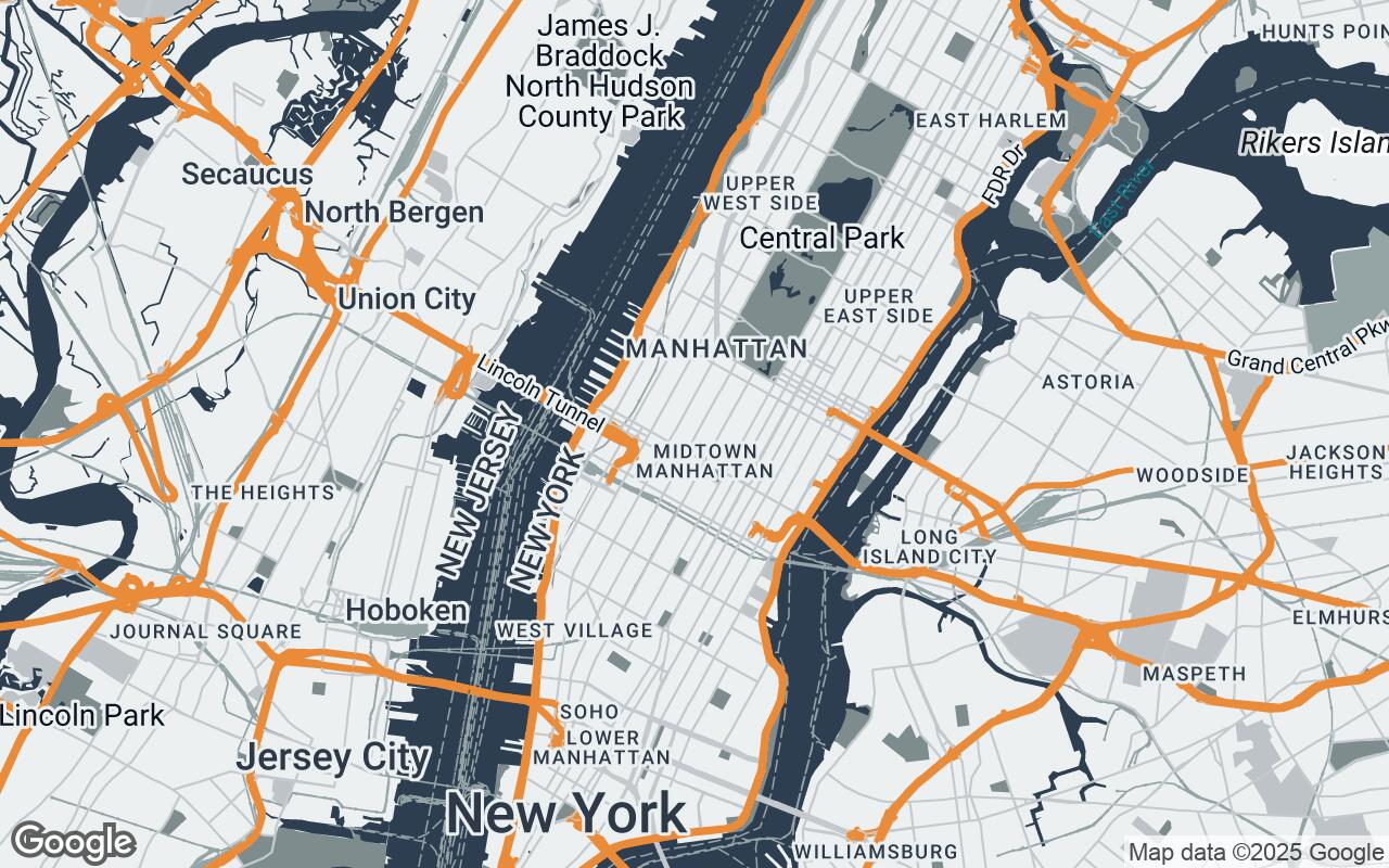
This Google Maps visual style transforms the traditional map into a sophisticated design tool. It emphasizes clarity, accurate representation of urban fabric, and a muted color palette that allows design elements to stand out. Ideal for site analysis, client presentations, and conceptual design, SpatialCanvas prioritizes legibility and professional utility.
Who it's for: SpatialCanvas is designed for architects, urban planners, and interior designers who require a clean, precise, and aesthetically refined map interface. It provides essential contextual information without visual clutter, enabling focus on spatial relationships and design integration.
Introduction: The Need for Specialized Cartography in Design
This section explains how the style improves clarity, reduces visual noise, and preserves hierarchy so roads, water, parks, and key POIs read at a glance.
Understanding the Architect's Perspective: Beyond Basic Navigation
This section explains how the style improves clarity, reduces visual noise, and preserves hierarchy so roads, water, parks, and key POIs read at a glance.
SpatialCanvas Philosophy: Clarity, Precision, and Professional Aesthetics
This section explains how the style improves clarity, reduces visual noise, and preserves hierarchy so roads, water, parks, and key POIs read at a glance.
Key Design Principles: How We Built a Designer-Centric Map
- Clarity over Clutter
- Precision in Representation
- Subtle Sophistication
- Contextual Relevance
- Print-Friendly Aesthetics
- Scalable Detail
- Minimizing Distractions
Palette and Typography: A Muted Foundation for Focused Work
- Primary: #2C3E50
- Secondary: #7F8C8D
- Accent: #E67E22
- Neutrals: #ECF0F1, #BDC3C7, #95A5A6, #34495E
Deconstructing the Visuals: Roads, Buildings, Water, and Green Spaces
This section explains how the style improves clarity, reduces visual noise, and preserves hierarchy so roads, water, parks, and key POIs read at a glance.
Intelligent Labeling: Essential Information, Minimal Clutter
This section explains how the style improves clarity, reduces visual noise, and preserves hierarchy so roads, water, parks, and key POIs read at a glance.
Practical Applications: Site Analysis, Client Presentations, and Urban Planning
This section explains how the style improves clarity, reduces visual noise, and preserves hierarchy so roads, water, parks, and key POIs read at a glance.
Integrating SpatialCanvas: A Seamless Workflow for Design Professionals
This section explains how the style improves clarity, reduces visual noise, and preserves hierarchy so roads, water, parks, and key POIs read at a glance.
The Future of Design Cartography: Evolving Tools for Creative Minds
This section explains how the style improves clarity, reduces visual noise, and preserves hierarchy so roads, water, parks, and key POIs read at a glance.