Spatial Blueprint: Google Maps for the Architectural Visionary
Transforming Urban Data into Design-Ready Insights for Architects and Interior Designers
Spatial Blueprint: Google Maps for the Architectural Visionary
Transforming Urban Data into Design-Ready Insights for Architects and Interior Designers
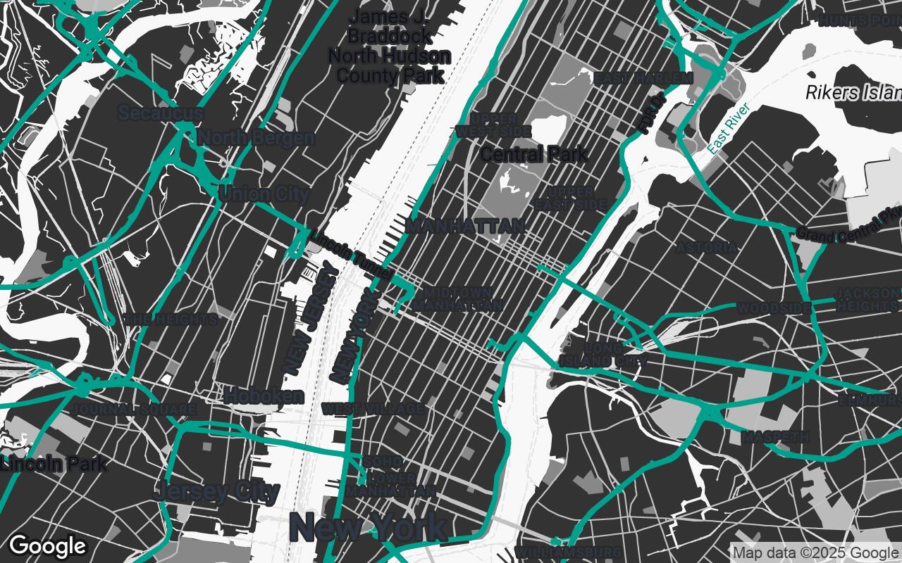
The Spatial Blueprint Google Maps style transforms standard mapping into an indispensable tool for design professionals. It emphasizes structural clarity, material context, and a refined aesthetic, allowing users to quickly grasp spatial relationships and integrate designs seamlessly. This style strips away visual clutter, highlighting essential elements crucial for architectural and interior design projects, making it ideal for site analysis, urban planning, and client presentations.
Who it's for: Designed for architects, interior designers, and urban planners, this style offers a clean, precise, and context-rich view of the built environment, prioritizing clarity and aesthetic appeal in project planning and visualization.
The Need for Precision: Why standard maps fall short for design professionals.
This section explains how the style improves clarity, reduces visual noise, and preserves hierarchy so roads, water, parks, and key POIs read at a glance.
Introducing Spatial Blueprint: A New Paradigm for Design-Centric Mapping.
This section explains how the style improves clarity, reduces visual noise, and preserves hierarchy so roads, water, parks, and key POIs read at a glance.
Core Design Principles: Clarity, Hierarchy, and Context in Urban Cartography.
- Clarity over Clutter: Prioritize essential architectural and urban elements.
- Subtle Hierarchy: Use a muted color palette and varied line weights to guide attention.
- Contextual Awareness: Provide sufficient environmental detail without overwhelming.
- Print-Ready Aesthetics: Designed for both digital and high-quality print outputs.
- Materiality Cues: Suggest different urban textures through subtle shading and color.
- Legibility at Scale: Maintain label and feature readability across zoom levels.
- Non-Intrusive Design: Allow user-added data to stand out against a clean base.
Palette and Aesthetics: Crafting a Professional and Print-Ready Visual Language.
- Primary: #2C3E50
- Secondary: #7F8C8D
- Accent: #2ECC71
- Neutrals: #ECF0F1, #BDC3C7, #95A5A6, #34495E
Key Features for Architects: Enhanced Building Detail and Site Analysis.
This section explains how the style improves clarity, reduces visual noise, and preserves hierarchy so roads, water, parks, and key POIs read at a glance.
Benefits for Interior Designers: Understanding Local Context and Material Flow.
This section explains how the style improves clarity, reduces visual noise, and preserves hierarchy so roads, water, parks, and key POIs read at a glance.
Customization and Integration: How Spatial Blueprint complements existing workflows.
This section explains how the style improves clarity, reduces visual noise, and preserves hierarchy so roads, water, parks, and key POIs read at a glance.
From Concept to Construction: Leveraging the Map for Every Project Phase.
This section explains how the style improves clarity, reduces visual noise, and preserves hierarchy so roads, water, parks, and key POIs read at a glance.
Future-Proofing Design: Adapting to Evolving Urban Landscapes.
This section explains how the style improves clarity, reduces visual noise, and preserves hierarchy so roads, water, parks, and key POIs read at a glance.