Designing the Invisible: A Cartographic Approach for Architectural Visionaries
How 'UrbanBlueprint' Google Maps Style Elevates Spatial Understanding for Architects and Interior Designers
Designing the Invisible: A Cartographic Approach for Architectural Visionaries
Subtitle: How 'UrbanBlueprint' Google Maps Style Elevates Spatial Understanding for Architects and Interior Designers
Introduction to UrbanBlueprint: Redefining Maps for Design Professionals
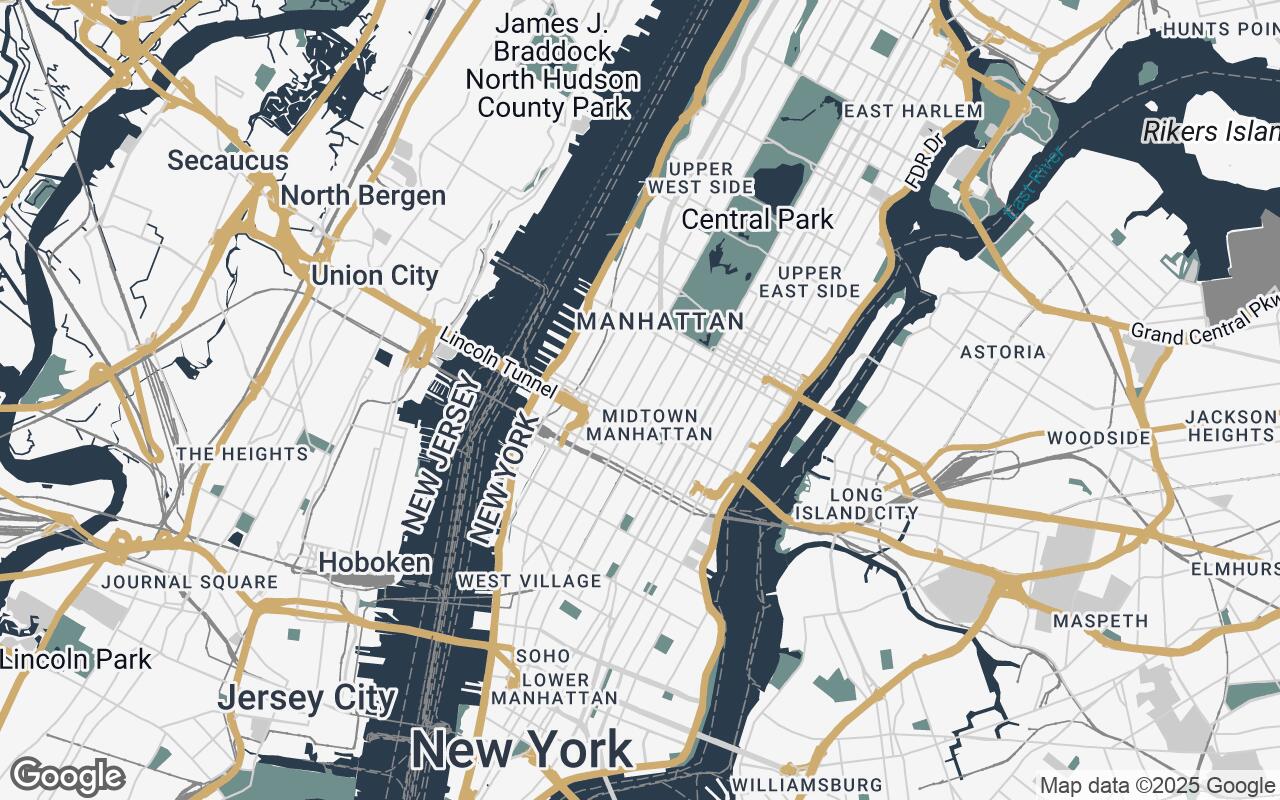
For architects, urban planners, and interior designers, the map is more than just a navigational tool; it's a foundational canvas, a critical source of context, and often, the very starting point of a vision. Yet, for too long, design professionals have had to contend with generic mapping solutions, cluttered with irrelevant information and visual noise that obscures the very details they need most. Standard maps, designed for the general public, often prioritize tourist attractions, traffic data, or vibrant aesthetics over the precise, uncluttered spatial information essential for professional design work.
Enter UrbanBlueprint, a revolutionary Google Maps visual style meticulously crafted for the discerning eye of the design professional. UrbanBlueprint transforms the standard map into a powerful, elegant, and highly functional instrument, emphasizing the built environment and reducing visual distractions. It's not just a new look; it's a new lens through which to perceive and interact with the urban landscape, providing an unparalleled level of clarity and precision for critical spatial analysis and design conceptualization.
The Critical Need for a Specialized Map Style in Architecture and Interior Design
Imagine trying to sketch a detailed building elevation on a page filled with vibrant advertisements. This analogy captures the frustration many architects and designers face daily. Generic maps, while excellent for navigation, present several challenges for design professionals:
- Visual Clutter: Overlapping labels, excessive points of interest, and distracting iconography obscure essential urban fabric.
- Lack of Hierarchy: Key architectural elements like building footprints and infrastructure often blend into the background.
- Inappropriate Aesthetics: Bright, consumer-oriented color palettes can clash with professional design presentations and hinder focus.
- Difficulty in Contextual Analysis: Extracting relevant data for site analysis, zoning, or material sourcing becomes a tedious task.
UrbanBlueprint addresses these pain points directly, offering a sophisticated, uncluttered view that allows professionals to quickly grasp spatial relationships and contextual details relevant to their projects, from initial site selection to detailed urban planning.
Unpacking UrbanBlueprint's Core Design Principles for Enhanced Clarity
UrbanBlueprint isn't just a collection of aesthetic choices; it's built upon a foundation of carefully considered design principles, each aimed at enhancing the professional's workflow and understanding:
- Clarity over clutter: Every element is scrutinized for its necessity. Unnecessary visual elements are minimized or removed to focus on essential data, ensuring that the map serves as a clean backdrop for design thought.
- Aesthetic harmony: We employ a sophisticated, muted palette that complements professional design work, ensuring the map integrates seamlessly into presentations and design documents without overpowering the primary content.
- Precision in representation: Building footprints and key infrastructure are highlighted with sharp, clean lines, providing an accurate and immediate understanding of the built form.
- Contextual awareness: While prioritizing the built environment, UrbanBlueprint provides just enough natural and environmental detail (like parks and water bodies) without overwhelming the primary architectural focus.
- Professional elegance: The style maintains a timeless, understated aesthetic suitable for high-level design discourse, reflecting the gravitas of architectural and urban planning projects.
- Subtle hierarchy: Variations in line weight, fill, and text size are strategically used to guide the eye to important information, creating an intuitive visual flow.
- Timeless appeal: By avoiding trendy elements, UrbanBlueprint ensures long-term relevance and usability, making it a lasting tool in your professional arsenal.
The Psychology of Color: Understanding UrbanBlueprint's Palette Choices
The UrbanBlueprint palette is a deliberate choice, designed to evoke professionalism, clarity, and focus. It moves away from the vibrant, often distracting hues of consumer maps towards a sophisticated, functional aesthetic.
- Primary (
#2A3B4C- Dark Slate Blue): This deep, authoritative tone forms the backbone of the map, often used for major roads, water bodies, or significant land features. It grounds the map, providing a sense of stability and depth. - Secondary (
#6E8F8C- Muted Teal): A calming, sophisticated secondary color, this hue is ideal for parks, green spaces, or less prominent infrastructure. It introduces a subtle natural element without competing with the built environment. - Accent (
#C8A35F- Warm Gold/Bronze): This carefully chosen accent color provides a touch of warmth and highlights critical points of interest or specific project areas. It draws the eye without being garish, adding a refined touch. - Neutrals (
#F5F5F5,#CCCCCC,#888888,#555555): A gradient of light to dark grays forms the foundation for buildings, background elements, and text. These neutrals ensure high readability and allow the primary and accent colors to stand out purposefully, creating a clean, professional look that minimizes visual fatigue.
This palette is not merely decorative; it's a functional language, guiding the user's eye and enhancing the interpretation of complex spatial data.
Geometry First: How Building Footprints and Infrastructure Take Center Stage
At the heart of UrbanBlueprint's utility is its unwavering focus on the built environment. Unlike standard maps where buildings might be represented as simple blocks or textures, UrbanBlueprint renders building footprints with crisp, defined edges. This precision is paramount for:
- Site Analysis: Accurately assessing existing structures, setbacks, and potential massing.
- Urban Context: Understanding the density, scale, and rhythm of the surrounding urban fabric.
- Shadow Studies: Providing a clear basis for environmental impact assessments.
Similarly, infrastructure elements like roads, railways, and public transport lines are depicted with a clear hierarchy of line weights and colors, ensuring their functional importance is immediately apparent without overwhelming the map with unnecessary detail. This 'geometry first' approach ensures that the fundamental elements of urban design are always at the forefront.
Precision in Labeling: Ensuring Readability Without Visual Clutter
One of the most common frustrations with generic maps is the chaotic nature of labels. UrbanBlueprint tackles this head-on with a sophisticated labeling strategy:
- Minimalism: Only essential labels are displayed, reducing cognitive load.
- Contextual Display: Labels appear and disappear intelligently based on zoom level and relevance.
- Legible Typography: A carefully selected, professional typeface ensures maximum readability, even at smaller sizes.
- Strategic Placement: Labels are positioned to avoid overlapping with key architectural features, maintaining the integrity of the visual information.
This meticulous approach to labeling ensures that critical information is always accessible and clear, without ever detracting from the primary visual data of the built environment.
Practical Applications: Leveraging UrbanBlueprint in Project Planning and Site Analysis
UrbanBlueprint is more than just a pretty map; it's a powerful tool designed to integrate seamlessly into various stages of your design process:
- Initial Site Selection: Quickly evaluate potential sites based on existing infrastructure, surrounding building mass, and green spaces.
- Contextual Studies: Understand the urban fabric, pedestrian flows, and vehicular access points relevant to your project.
- Client Presentations: Present site plans and contextual information with a professional, elegant aesthetic that reinforces your design vision.
- Urban Planning & Zoning: Analyze existing zoning boundaries, land use, and potential development opportunities with enhanced clarity.
- Interior Design Context: For larger-scale interior projects, understand the building's relationship to its immediate surroundings and access points.
By providing a clear, focused view, UrbanBlueprint empowers designers to make more informed decisions, faster.
Integrating UrbanBlueprint into Your Daily Workflow and Design Software
UrbanBlueprint is designed for ease of integration. As a Google Maps style, it can be readily implemented across various platforms and applications that utilize the Google Maps API. This means you can:
- Embed in Web Applications: Integrate the style into your project management portals or client-facing dashboards.
- Utilize in GIS Software: Export and overlay your design data onto UrbanBlueprint's clean base map.
- Enhance Presentations: Use high-resolution screenshots of UrbanBlueprint maps in your design proposals and reports.
Future developments aim to provide even more direct integration options with popular CAD and BIM software, streamlining the transition from map analysis to design execution.
Future Directions: Potential Enhancements and Community-Driven Features
The journey of UrbanBlueprint is just beginning. We envision a future where this style evolves with the needs of the design community. Potential enhancements include:
- Customizable Layers: Allowing users to toggle specific data layers (e.g., public transport, specific building types) based on project needs.
- 3D Building Integration: Enhanced 3D representations of buildings for more immersive contextual understanding.
- Thematic Mapping Overlays: Tools to easily visualize data like population density, land value, or environmental factors directly on the UrbanBlueprint base.
- Community Feedback Loop: A dedicated platform for architects and designers to suggest new features and refinements.
Your insights will be invaluable in shaping the next generation of UrbanBlueprint.
Conclusion: Mapping the Future of Spatial Design with UrbanBlueprint
UrbanBlueprint is more than just a map style; it's a commitment to elevating the tools available to architects, urban planners, and interior designers. By prioritizing clarity, precision, and professional elegance, it transforms the often-overlooked map into an indispensable asset in the design process. It empowers you to see beyond the noise, to understand the invisible forces that shape our built environment, and to design with greater insight and confidence.
Step into a new era of spatial understanding. Experience UrbanBlueprint and redefine how you see the world – and how you design within it.