ConstructView: Redefining Cartography for the Design Professional
A Google Maps Style Engineered for Architects, Urban Planners, and Interior Designers.
ConstructView: Redefining Cartography for the Design Professional
A Google Maps Style Engineered for Architects, Urban Planners, and Interior Designers.
In the intricate world of architecture, urban planning, and interior design, every detail matters. From the subtle nuances of a site's topography to the grand sweep of an urban fabric, understanding context is paramount. Yet, for too long, design professionals have relied on generic mapping solutions – tools built for navigation, not for nuanced spatial analysis or aesthetic inspiration. These maps, while functional, often present a visual cacophony, obscuring the very details crucial for informed design decisions.
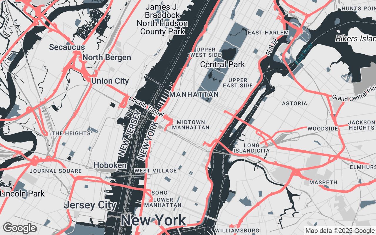
Enter ConstructView, a revolutionary Google Maps style meticulously tailored for architects, urban planners, and interior designers. ConstructView provides a precise and aesthetically refined lens for urban exploration, transforming Google Maps into an indispensable tool for site analysis and design inspiration. It reimagines digital cartography with a singular focus on the built environment, stripping away visual clutter to highlight architectural forms, material textures, and spatial relationships crucial for design professionals. The style offers a sophisticated, blueprint-inspired aesthetic that enhances legibility and supports detailed project planning and visualization.
The ConstructView Philosophy: Precision, Clarity, and Aesthetic Appeal
At the heart of ConstructView lies a deep understanding of the design process. Our philosophy is built on principles that resonate with the core values of the design community:
- Clarity over Clutter: We prioritize essential architectural and urban details, ensuring that what you see is what you need.
- Hierarchical Information: Through intelligent use of color and line weight, critical data is brought to the forefront, guiding your eye effortlessly.
- Materiality Focus: Subtle visual cues suggest different urban surfaces and building types, adding depth to your understanding of a site.
- Contextual Awareness: ConstructView enables quick and intuitive understanding of a site's surroundings, from adjacent structures to green spaces.
- Timeless Modernity: We blend classic drafting aesthetics with contemporary digital design, creating a look that is both familiar and forward-thinking.
- Precision in Representation: Accuracy in geometry and scale perception is paramount, ensuring your analysis is always grounded in reality.
- Inspiration Through Detail: Beyond functionality, ConstructView provides subtle visual textures that are designed to spark creative thought and inform your design narrative.
Blueprint-Inspired Aesthetics: Visual Language for the Built Environment
ConstructView's visual language is a deliberate homage to the clarity and precision of architectural blueprints. Imagine the crisp lines, the thoughtful layering of information, and the understated elegance of a master plan – now translated into a dynamic, interactive digital map. This aesthetic choice isn't merely stylistic; it's functional. By adopting a visual grammar familiar to designers, ConstructView reduces cognitive load, allowing you to focus on the spatial relationships and design opportunities rather than deciphering extraneous visual noise.
Key Features: How ConstructView Enhances Site Analysis and Planning
ConstructView is more than just a pretty map; it's a powerful analytical instrument:
- Enhanced Site Analysis: Quickly identify building footprints, property lines (where available), and surrounding infrastructure with unparalleled clarity.
- Urban Fabric Comprehension: Understand the density, scale, and typology of neighboring structures, crucial for contextual design.
- Materiality Cues: Subtle shading and texture variations hint at different building materials or urban surfaces, aiding in preliminary material palette considerations.
- Green Space Definition: Parks, plazas, and natural features are rendered distinctly, allowing for better integration of landscape architecture into your designs.
- Traffic Flow Visualization: Roads and pathways are depicted with a hierarchy that helps assess accessibility and pedestrian movement patterns.
Palette and Typography: A Modern Approach to Legibility
The visual integrity of ConstructView is underpinned by a carefully curated palette and thoughtful typography. Our primary color, a deep #2A363B, provides a strong, grounding base, reminiscent of traditional ink on paper. This is complemented by a sophisticated secondary hue, #6A7F8E, which offers a softer contrast for less dominant features. Our neutral tones – ranging from light #E8E8E8 to a darker #707070 – create a harmonious backdrop, ensuring that the map's elements breathe and stand out without overwhelming the eye. The accent color, a vibrant #FF6B6B, is strategically deployed to highlight critical points of interest or specific data layers, drawing immediate attention where needed.
Typography is chosen for its legibility and clean lines, ensuring that labels, street names, and points of interest are clear and concise, even at varying zoom levels. This meticulous attention to visual detail ensures that every piece of information is presented with maximum clarity and minimal distraction.
Distinguishing Elements: Buildings, Roads, and Green Spaces Reimagined
ConstructView redefines how you perceive the built environment on a map. Buildings are rendered with a focus on their volumetric presence, often with subtle shadows that give a sense of height and mass, crucial for understanding urban canyons or skyline impacts. Roads are not just lines; their widths and classifications are visually distinct, allowing for quick assessment of traffic capacity and pedestrian zones. Green spaces are depicted with a natural, yet stylized, texture that differentiates them clearly from hardscapes, emphasizing their role in urban ecology and public amenity. This reimagining ensures that the map is not just a representation, but a functional model of the urban landscape.
Beyond Navigation: Using ConstructView for Design Inspiration and Presentation
While its analytical capabilities are robust, ConstructView also serves as a powerful source of inspiration. The clean, architectural aesthetic can spark new ideas for site integration, material choices, or urban interventions. Imagine using a ConstructView map as the backdrop for a client presentation, showcasing your proposed design within a context that is both professional and visually compelling. It elevates your project's narrative, demonstrating a deep understanding of the site and its surroundings.
Integration with Design Workflows: Practical Applications
ConstructView is designed to seamlessly integrate into your existing design workflows:
- Conceptual Design: Use it for initial site visits and conceptual sketching, quickly understanding the lay of the land.
- Client Communication: Present your designs within a professional, context-rich map that clients can easily understand.
- Urban Planning Studies: Analyze zoning, density, and infrastructure for large-scale urban projects.
- Interior Design Context: Even for interior projects, understanding the building's immediate exterior context and access points is invaluable.
The Future of Design-Centric Mapping
ConstructView represents a significant leap forward in design-centric mapping. It's more than just a new style; it's a commitment to providing design professionals with the precise, aesthetically refined tools they deserve. As urban environments grow more complex and design challenges become more intricate, the need for specialized cartography will only intensify. ConstructView is here to meet that need, empowering architects, urban planners, and interior designers to explore, analyze, and create with unprecedented clarity and inspiration. Discover how ConstructView can transform your approach to design, one meticulously rendered detail at a time.