Atelier Cartography: Redefining Google Maps for Architectural and Interior Design
Elevate your site analysis and client presentations with a visually sophisticated and functionally precise map style.
Atelier Cartography: Redefining Google Maps for Architectural and Interior Design
Elevate your site analysis and client presentations with a visually sophisticated and functionally precise map style.
For practicing architects, interior designers, and urban planners, the map is more than just a navigational tool; it's a foundational canvas for understanding context, analyzing sites, and communicating design intent. Yet, for too long, professionals have been forced to adapt consumer-grade mapping solutions to their highly specialized needs. This ends now.
The Design Professional's Dilemma: Why Standard Maps Fall Short
Standard Google Maps, while incredibly powerful for general navigation, often fall short of the nuanced requirements of the design professional. Their default settings are optimized for the everyday user, prioritizing points of interest (POIs) like restaurants and shops, vibrant color schemes, and busy road networks. While useful for finding a coffee shop, this visual clutter becomes a significant impediment when trying to:
- Analyze urban fabric: Distracting icons obscure building footprints and street patterns.
- Assess site context: Overly bright colors and prominent labels detract from the subtle interplay of built and unbuilt spaces.
- Prepare professional presentations: A consumer-centric aesthetic clashes with the refined visual language of architectural drawings and renderings.
- Focus on spatial relationships: The sheer volume of non-essential information makes it difficult to discern critical adjacencies and site boundaries.
This forces designers to either spend valuable time manually editing screenshots or present maps that undermine the sophistication of their work. The need for a map style that speaks the language of design has never been clearer.
Introducing Atelier Cartography: A New Vision for Spatial Context
We are thrilled to introduce Atelier Cartography, a groundbreaking Google Maps style meticulously crafted for the design professional. Atelier Cartography redefines Google Maps by prioritizing clear urban fabric, detailed building footprints, and a sophisticated color palette, minimizing visual clutter to enhance focus on spatial relationships and design potential. It offers a refined aesthetic that complements professional workflows, moving beyond consumer-centric map styles.
Our mission is to provide architects and interior designers with a visually clean, information-rich map interface that supports precise spatial analysis and contextual understanding for site planning, material selection, and client presentations. We believe that maps should be as aesthetically considered and functionally precise as the designs they inform.
Core Design Principles: Clarity, Sophistication, and Functionality
At the heart of Atelier Cartography lies a set of carefully considered design principles, each aimed at elevating the professional's mapping experience:
- Clarity over Clutter: We prioritize essential design-relevant information, stripping away distracting POIs and simplifying road networks to reveal the underlying urban structure.
- Subtle Sophistication: Muted tones and refined geometries create a calm, professional backdrop that allows your design elements to take center stage.
- Contextual Awareness: The style emphasizes urban fabric and site boundaries, providing an immediate and intuitive understanding of a project's surroundings.
- Scalable Detail: Information density adapts gracefully across zoom levels, ensuring a smooth and relevant experience whether you're viewing an entire city or a specific building footprint.
- Professional Aesthetic: Atelier Cartography offers a style that aligns seamlessly with high-quality design presentation standards, enhancing your visual communication.
- Functional Elegance: Every aesthetic choice serves a practical purpose, ensuring that beauty enhances utility rather than merely decorating it.
- Unobtrusive Labeling: Labels are legible but not distracting, providing necessary information without creating visual noise.
The Palette of Precision: Earth Tones Meet Modern Accents
The visual identity of Atelier Cartography is defined by a carefully curated color palette that evokes a sense of grounded professionalism and modern elegance. Inspired by natural earth tones and architectural materials, this palette ensures that the map complements, rather than competes with, your design work.
- Primary Hues (
#5F7080): A sophisticated slate blue-gray forms the backbone of the map, used for primary text and key features, providing a stable and authoritative presence. - Secondary Tones (
#B2A79F): A warm, muted taupe offers a gentle contrast, ideal for secondary text and less prominent features, maintaining harmony. - Neutrals (
#F8F8F8,#E0E0E0,#3C3C3C,#DDE4D7,#C8C8C8): A range of soft grays, off-whites, and subtle greens define land, water, and road surfaces. These colors create a clean, breathable canvas, allowing architectural elements to stand out. - Accent (
#C26B4F): A rich, burnt orange provides a subtle yet impactful accent, strategically used to highlight specific features or points of interest when necessary, drawing attention without overwhelming the overall aesthetic.
This harmonious blend ensures that the map is both visually appealing and highly functional, reducing eye strain and enhancing focus on critical spatial data.
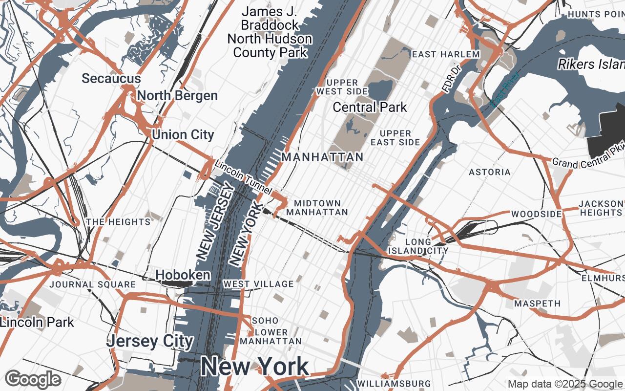
Unpacking the Visuals: How Buildings, Roads, and Landscapes are Rendered
Every element within Atelier Cartography has been re-imagined to serve the design professional:
Buildings
Building footprints are rendered with crisp, clean lines and subtle, consistent shading. This approach clearly delineates individual structures and their massing, allowing for immediate recognition of urban density and architectural context. The focus is on form and relationship, not on distracting textures or colors.
Roads and Infrastructure
Road networks are simplified, with a clear hierarchy that distinguishes major arteries from local streets. Muted grays and subtle outlines ensure that roads provide necessary context without dominating the visual field. Pedestrian pathways and public transport lines are rendered with similar restraint, emphasizing connectivity without clutter.
Landscapes and Water Bodies
Green spaces, parks, and water bodies are depicted with natural, muted tones. Soft greens for parks and a serene blue for water ensure these elements are distinct but blend harmoniously into the overall palette. This allows designers to easily identify natural features and their integration into the built environment.
Intelligent Labeling: Information Without Distraction
Atelier Cartography's labeling system is a testament to the principle of